Published on · By Ricard Prehn, yachtmaster and sailing instructor for more than 27 years
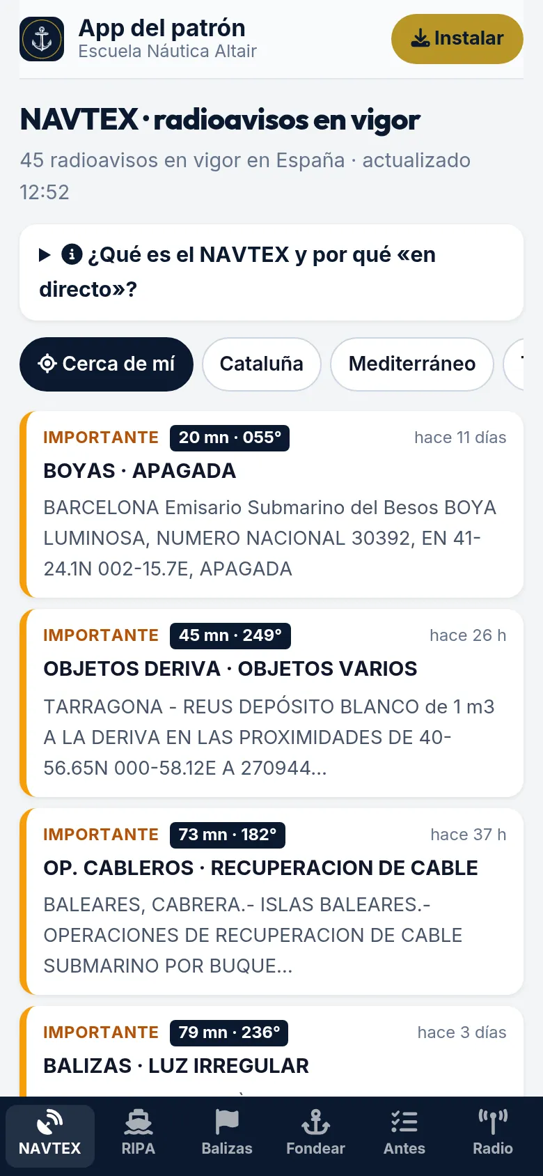
The Skipper app is free, needs no account and is not downloaded from any store: open escuelanauticaaltair.com/app and add it to your home screen. It has live NAVTEX warnings (and how many miles away they are), COLREGs with diagrams, buoyage, how to anchor, a pre-departure checklist and the MAYDAY script. The app is in Spanish.
What is the Skipper app?
It is a free app from Escuela Náutica Altair that puts on your phone what a skipper checks on board: live NAVTEX warnings, who gives way under COLREGs, lights and shapes, buoyage, how to anchor, a pre-departure checklist and what to say on the radio in an emergency. It is in Spanish.
What is in it?
- Live NAVTEX. The warnings Salvamento Marítimo has in force right now: unlit buoys, objects adrift, exercises, cables… By area (Catalonia, Mediterranean, all Spain) or near you, with distance in miles and bearing. See also what NAVTEX is.
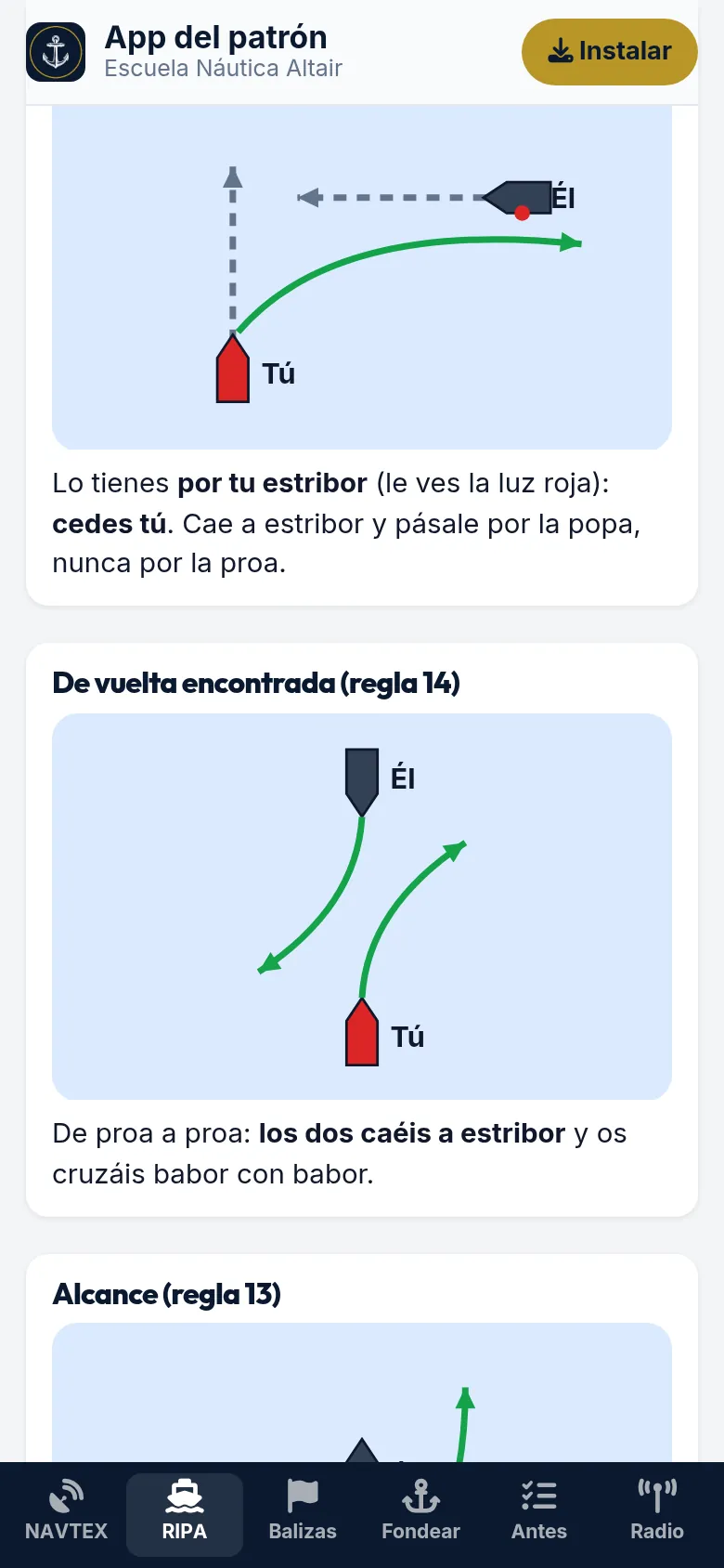
- COLREGs with diagrams. The hierarchy, crossing, head-on, overtaking and sailing boats, each with a diagram; a power vessel's lights, the lights and day shapes of each type of vessel, and sound signals. To go deeper: who has right of way.
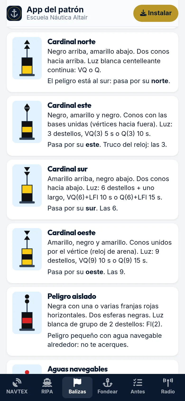
- Buoyage. The ten IALA A marks used in Europe, drawn, with their light and which side to pass.
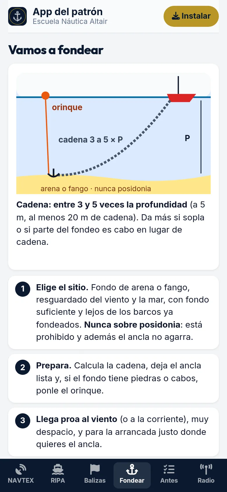
- Let’s anchor. The manoeuvre step by step, how much chain to let out (3 to 5 times the depth), what the tripping line is for and how the boat swings, with diagrams.
- Waves now. Wave height, maximum wave, period, direction and water temperature measured right now by the Puertos del Estado buoys, from Barcelona to the Canaries, with the last 48 hours on a chart.
- Chart with your position. Your boat on the free OpenSeaMap chart (buoys, lighthouses and lights) using your phone’s GPS: speed, course and your position written out ready to read in a MAYDAY. Not an official chart: an aid.
- Animated knots. Bowline, clove hitch, cleat, ring hitch, reef knot and sheet bend, step by step and with the typical mistake for each: the same animations as our online classroom.
- Useful links. AEMET and Meteocat marine forecasts, Windy, Puertos del Estado buoys, notices to mariners and exam dates.
- Before you leave. Twelve checks to tick off: weather, fuel, engine, lifejackets, radio… They reset the next day.
- Radio. How to send the DSC alert, the MAYDAY script, PAN PAN and SÉCURITÉ, and channels 16, 70 and 9 (the marinas’ channel).
How do I install it without an app store?
It is a web app: it opens in the browser and you add it to your home screen. On Android, tap «Instalar» inside the app (or «Add to home screen» in the Chrome menu). On iPhone, open it in Safari, tap Share and «Add to Home Screen». It gets its own icon like any other app.
Why did we make it?
Because it is what students ask me once they have their licence: «how did the cardinals go?», «how much chain here?», «does the boat on my starboard give way or not?». After more than 27 years teaching, I know you pass the exam and then forget COLREGs unless they are at hand. And hardly anyone carries NAVTEX on a small boat, even though the warnings affect you just the same: an unlit buoy at the harbour entrance or a container adrift on your route.
Does it work offline?
Yes. All the COLREGs, buoyage, anchoring and radio content is always available, and for NAVTEX you see the last warnings you received. To keep them current you need a connection: they refresh every 10 minutes. The chart does need a connection to load the map.
Is it free? Do I need an account?
Yes, it is free and asks for no account, email or data. At the bottom of each screen there is a small box about our trips and courses, which you can close.
Where do the warnings come from?
From Salvamento Marítimo, which broadcasts them by NAVTEX in Spain. The app reads them from its website every 10 minutes. It is a reference tool: for navigation, your NAVTEX receiver and official information come first.